

Field creation and update
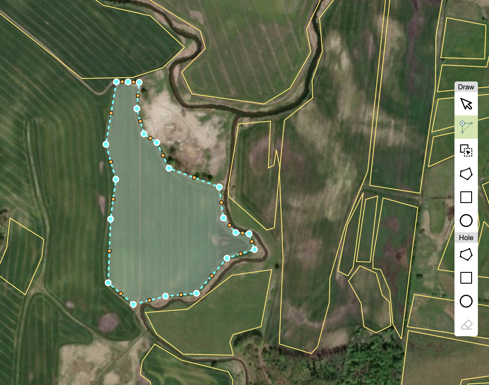
You can draw a field by choosing ‘draw a rectangle’ or ‘a circle’ option or ‘draw a polygon ‘. Once you have drawn the field, it will appear on the map already with its assigned Global FieldID. Additional field properties created in the system can be downloaded, such as: boundary reference, country, the coordinates of the geometry, and metadata.
When creating or updating fields the new field boundary cannot overlap with an already existing boundary; if it happens, the user must choose between adjusting the new boundary, trimming the sections overlapping the older field or deleting the old field.
The ‘Create a New Field’ feature is particularly useful when the area where your field or fields are situated has not been covered by Global FieldID yet. You can simply draw your field and a Global FieldID will be created automatically.
The ‘Update My Field’ feature enables you to modify boundaries, precisely tracing the shape of a field. Precise boundaries are critical in precision farming to develop accurate plans for fertilizer application, irrigation or for yield estimates.
Discover the Global FieldID User Interface.
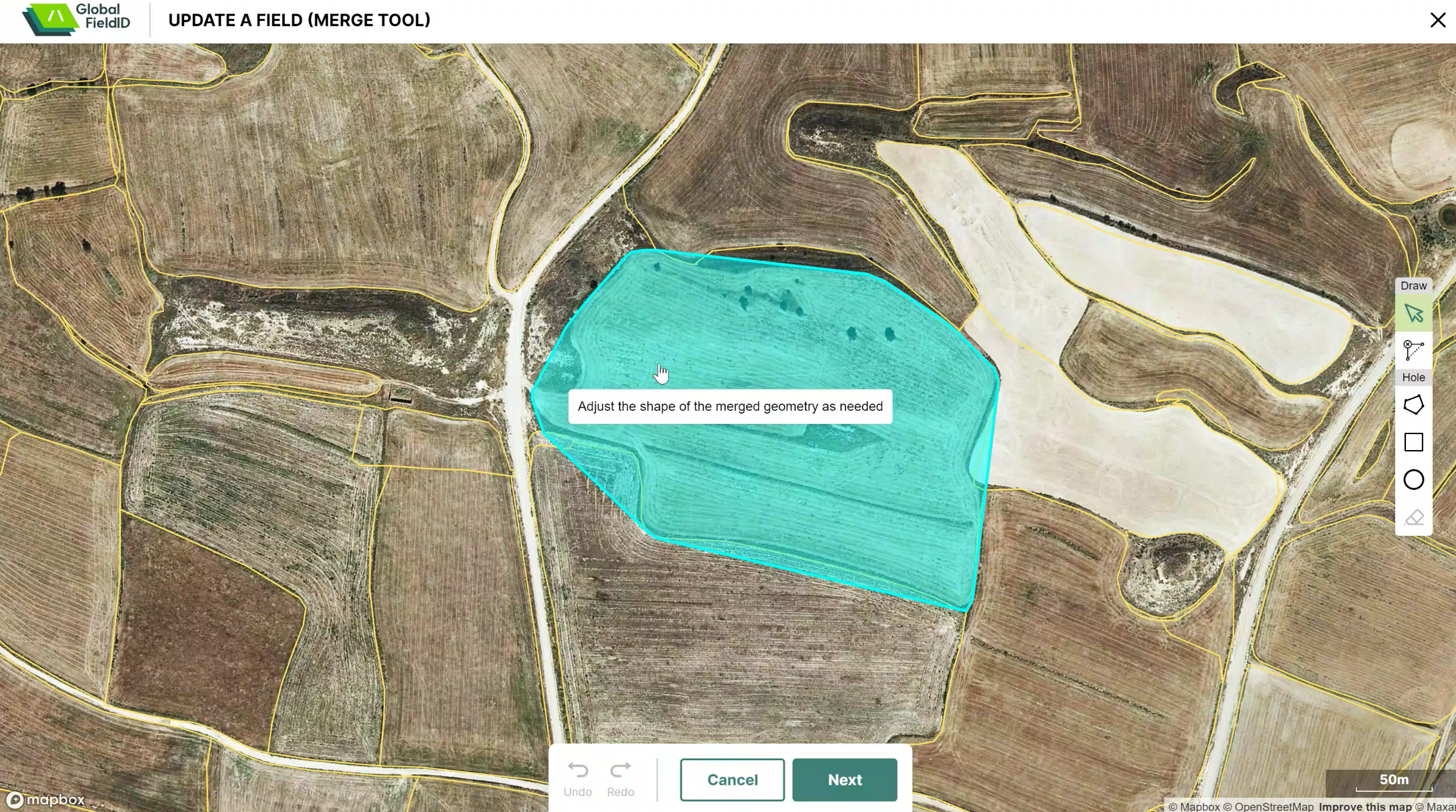
Merge and split fields & delete fields
The merging fields feature lets you replace two fields with one field that has a boundary encompassing these fields which, in turn, means that a new FieldID is registered, replacing the ones that have been merged.
In a similar way, fields can be split. The existing field boundary is deprecated (given an end date), and two new fields are created and assigned a new FieldID . The IDs of modified fields are not re-used.
The ‘delete fields function’ lets you delete field boundaries from the map. However, boundaries never disappear, they are deprecated, and new boundaries are created and assigned to a newly created field. The boundary history remains in the Global FieldID API, informing that the old field used to be there and has now been replaced by these two new fields.
Additional coverage
In recent months an additional five European countries have been added to the Global FieldID system. The field boundaries from Germany, Belgium, Poland, Denmark and Sweden have been added, reaching a total of around 116 million field boundaries across Europe and the Americas.
Next on our field coverage roadmap for Global FieldID, there is the first Asian country, India, which is currently being added. Two African countries, Tanzania and South Africa will follow! Stay tuned for more updates!
Visit the Global FieldID UI to discover the new features and geographies!


